Improved elevation profiles
Footpath’s newest 4.1 update significantly improves the elevation profiles in the app, with pinch-to-zoom, color-coded slope analysis, and distance and elevation stats for any point along the route.
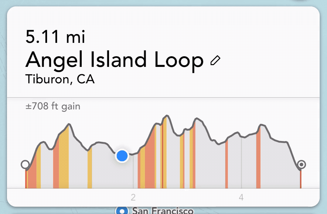
Pinch-to-zoom
You can now pinch and zoom in to the elevation profile graph to analyze a specific climb. You’ll be able to break down the distance, elevation gain and loss for just this climb. This is especially helpful on longer routes with multiple climbs or rolling hills. If you’re currently on your route, you’ll see your current location right on the elevation graph.
Color-coded slope analysis
If you’re an Elite user, you can analyze a slope’s percent grade and see all of the hardest climbs color-coded by difficulty, right on the map and graph. For runners, cyclists, and hikers, you’ll know exactly where you’ll be expending the most effort. If you’re a wheelchair user, you’ll know how to avoid hills that aren’t wheelchair-friendly.
Stats for any point along the route
Lastly, you can now tap on any point along a saved route to see the elevation and distance along or off route. Tap on your current location to see your current progress, or tap on that campsite and know that it’s only 1.6 miles ahead.
Head to the App Store to update to Footpath 4.1 and give the new and improved elevation profiles a try today!