Stay up to date with Footpath's latest releases, tips and tricks, and more.
Tips
Smarter training starts with a map
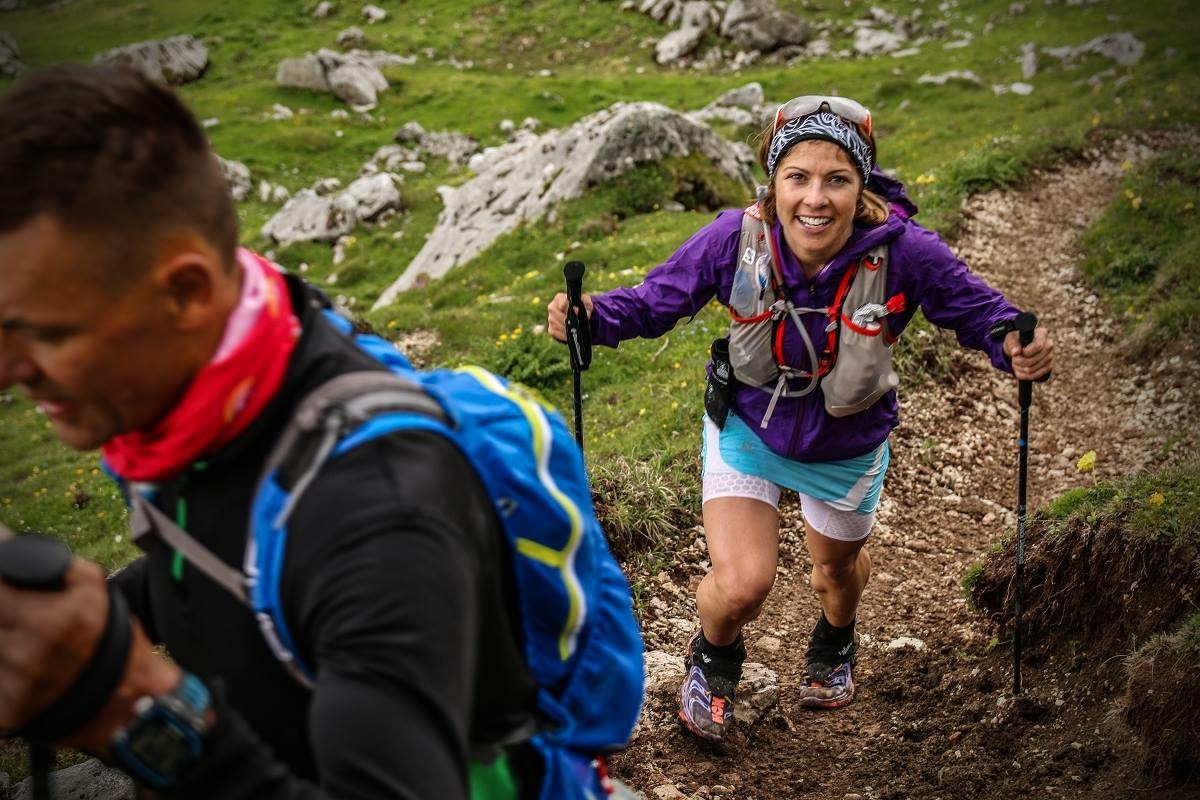
One of the most common mistakes I see in trail runners preparing for mountain races is surprisingly simple. They train for the distance, but not the terrain.
Release Notes
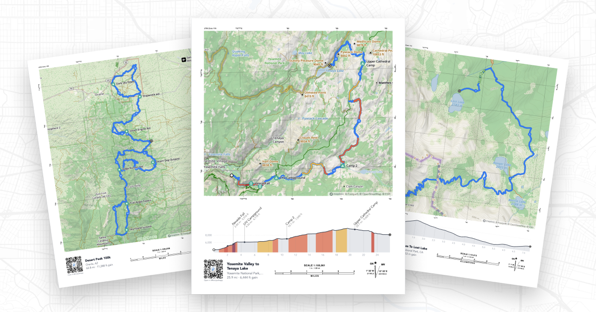
Introducing Print Maps
For serious adventurers, a good paper map is still an essential piece of kit, and if you’re a race director, trip leader, or community organizer, having a shareable visual helps others understand the course at a glance. Today, we’re making it easier than ever to create printed maps of your routes. Introducing Print Maps, a new feature for Footpath Elite subscribers that lets you generate high-quality, print-ready PDF maps of any route in your library.
Stop obsessing over distance, start studying elevation
Everyone loves talking about miles logged. Whether you’re a runner, cyclist, or hiker, distance is the easiest metric to share and compare. It’s clean, simple, and usually earns a reaction like, “I don’t even like driving that far.” But while mileage looks impressive in a training log or calendar screenshot, it’s actually a poor predictor of how difficult a route will feel. If you’ve ever finished a workout thinking, “That was way harder than I expected,” the problem probably wasn’t the distance.
Fire up your fitness with new routes
New year, fresh goals, big motivation. And then suddenly… you’re running the same route again. And again. It’s easy to assume that when fitness goals fall apart, it’s because of discipline. But more often than not, it’s boredom. Research consistently shows that most New Year’s goals fade within the first few weeks, not because people don’t care, but because the process stops being interesting. Movement thrives on curiosity. That’s where new routes come in.
A Local's Guide
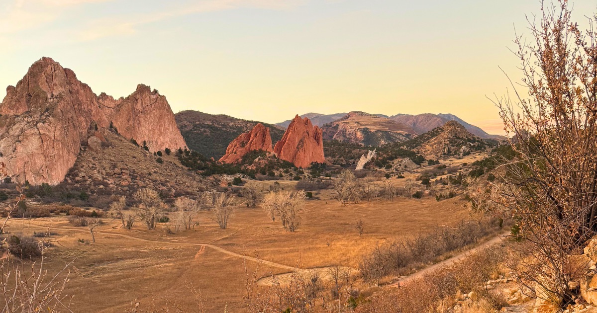
Best winter running routes in Colorado Springs
When people think of Colorado winters, they often picture a state buried in snow. While that can be true in the high country, it’s not the full story, especially in Colorado Springs. Many runners assume winter training here is impossible, but the Front Range proves otherwise. Winter running in Colorado Springs is magic: bright sun that makes it feel warmer than the forecast, crisp air, quiet trails, frosted pines, wildlife sightings, and sunrise colors that make you slow down mid-stride.
Inspiration
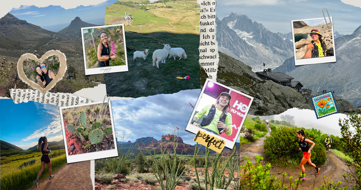
A year in maps: six routes I’ll never forget
The best routes stay with you long after the run is over. At Footpath, we love seeing how athletes use the map to discover new places, prepare for big efforts, and turn a squiggly line into memories with friends and teammates. This year, professional trail runner Mercedes Siegle-Gaither traveled the world chasing climbs, ridgelines, and the kind of trails you dream about. Footpath helped her plan, preview, and save the routes that defined those experiences.
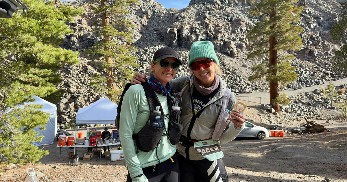
How to be an elite pacer using Footpath
Pacing an ultrarunner isn’t just about running beside them. Honestly, you’re rarely beside them. You’re usually a few steps ahead, a few steps behind, or setting a two-minute timer while they take a dirt nap in a pile of leaves. It’s about being their calm, confident navigator when the miles blur together, aid stations feel endless, and trail markers seem to disappear. Whether you’re guiding a friend through the night or helping an elite athlete chase a podium, your job as a pacer is to anticipate needs, stay on course, and keep spirits high.
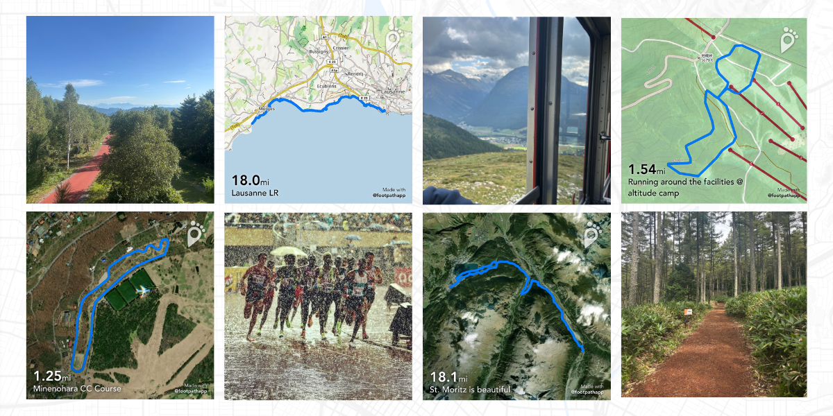
Graham Blanks’ top 5 summer routes
Footpath athlete Graham Blanks took to the global stage this summer, representing Team USA at the 2025 World Athletics Championships in Tokyo, where he finished 11th in the 10,000m final. While the race didn’t unfold the way he hoped, Graham approached it with the same honesty and self-awareness that have fueled his rise in the sport. Afterward, he reflected on the mental side of racing at the world level and shared that it was time to take a short break to reset and refocus, a mature move for any athlete chasing longevity and growth.
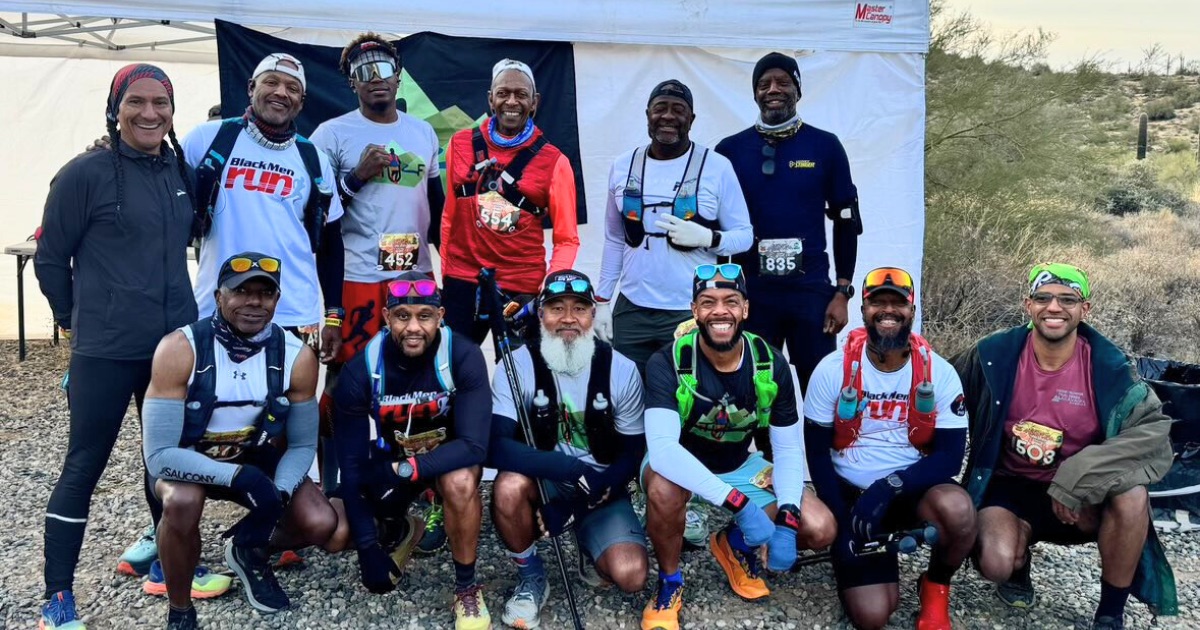
How to build community through run clubs
Run clubs are more than scheduled meetups on a calendar. They are spaces where runners come together to connect, build community, and share miles safely and inclusively. Behind every great group run is careful planning: choosing the route, setting expectations, managing pace groups, and making sure everyone feels welcomed. At Footpath, we know how important mapping is in this process. Routes help organizers plan logistics, communicate clearly with attendees, and keep everyone on course.