Route planning for multi-day adventures
 Jake Catterall’s 4-day, 350km route across Morocco’s High Atlas mountains
Planning a multi-day backpacking, running, bike touring, or ski mountaineering trip can feel overwhelming, but it doesn’t have to. With Footpath, you can easily map, organize, and adjust your entire adventure from the palm of your hand (or your laptop), using powerful tools built specifically for outdoor explorers.
We’re excited to have partnered with Amsterdam-based ultrarunner Jake Catterall to help share his incredible journey: a 350-kilometer supported run from the coast of Morocco all the way to the 4,167m (13,671 ft) summit of Mt. Toubkal in just over 4 days.
Watching Jake plan and execute such a complex, multi-day route inspired us to put together this guide. Whether you’re tackling a major expedition or linking up a few adventurous days on the trail, here’s how to plan smarter (and easier) with Footpath.
Sketch out your overview route
Trace the map with your finger to quickly map an overview route
When planning out a multi-day adventure, start first with the big picture, then narrow down the day-by-day details.
Use Footpath’s finger drawing feature to quickly sketch out your rough, high-level route. It’s easy to tweak and refine later (we’ll cover that), so have fun and don’t get too hung up on specifics.
Add waypoints to mark rest stops and break up your route into stages
Use waypoints to mark where you’d like to break up your route
Once you’ve got the high-level route mapped out and a total distance in mind, figure out how much distance you’d like to cover per day and then use the mile/kilometer markers along the route to find possible places to rest.
Mark good spots with a waypoint and name them something like Night 1 or Camp 2. You can also use waypoints to mark places to fill up on water, stop for food, or resupply.
Use custom lists to manage versions
Once you’ve got your rough stops marked out, save the overview route to a custom list. This will help you organize your variations as you refine them.
You can group different versions of your route (like your A, B, and C options) into one list, or break your big trip into day-by-day segments, saving each day as its own route within the list.
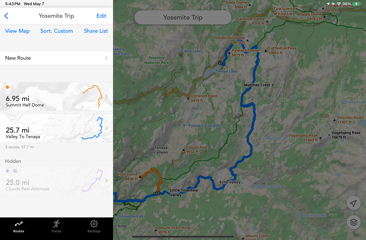 Color code and hide routes in a list
Within the custom list, you can hide routes, color code them, or custom sort them however you’d like.
Duplicate the route to tweak and refine
Take your saved route, tap the “More” button, and then tap “Duplicate route” to create a fresh copy.
Then, refine it! On mobile, you can trace back over sections of the route to edit them. And on desktop you can drag and delete control points to modify the route.
Use the eraser tool to break your route into separate stages
You can break the route into stages or days using the eraser tool to erase the overview route back to each waypoint marker you dropped. Then just save the duplicate route into your custom list as “Day 1”, “Day 2”, etc.
Add alternatives to the list
Beyond breaking up your overview route into multiple stages, you can also plot out alternative routes, such as “bail” routes, side excursions, or summits to attempt if you have extra time. This way, you’ll have backup options ready to go if plans shift along the way.
Color code these a different color to categorize these within your list.
Compare all of your options
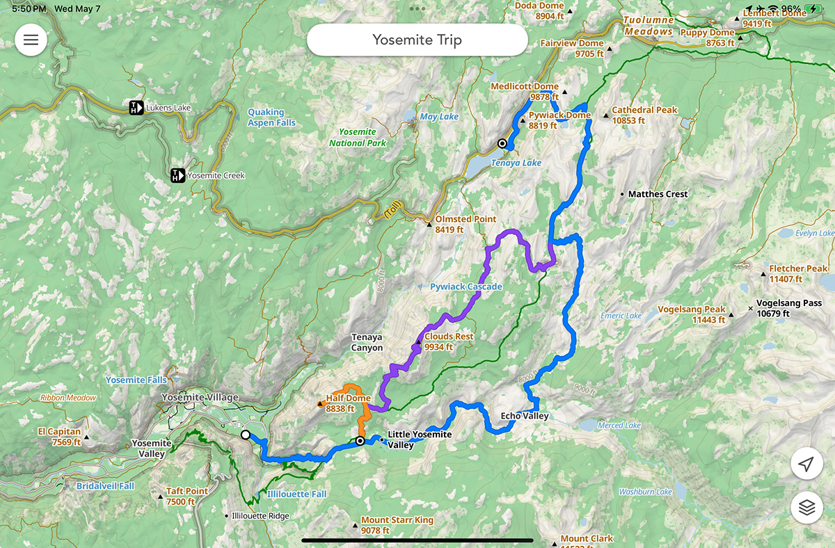 See all of a list’s routes on a single map
Once you’ve got your different variations in place, open your list and then tap the “View Map” button to see everything you’ve created on a single map.
Hit the trail
Before you head out on your trip, you can download offline maps, send the route to your Apple Watch or send the GPX file to your GPS watch.
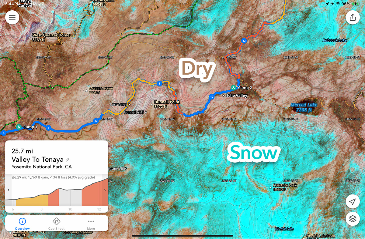 View snow cover with Satellite Live maps
You can also check recent satellite imagery for snow on the route or pre-visualize your route with 3D maps.
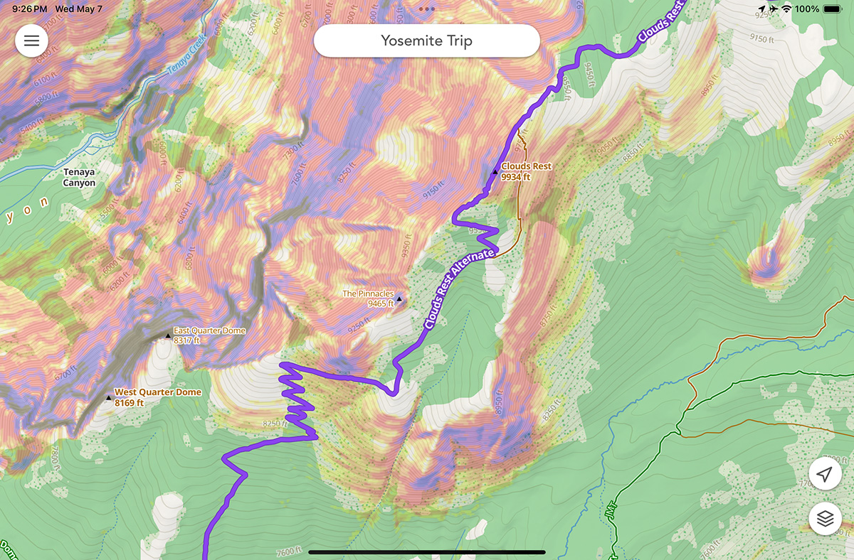 View steep slopes with the Slope Angle Overlay
Jake mentioned during his pre-adventure interview using the slope angle overlay to highlight steep and technical terrain. It’s incredibly useful when traversing rugged areas, helping you spot cliffs, loose scree fields, or even assess avalanche danger when traveling through snowy zones.
Good Planning = Safer Adventures
Epic trips start with great plans and great plans start with the right tools. Studying your route ahead of time with Footpath helps you build backup options, check real-time conditions, and sync your routes so you’re always ready, even offline.
Getting familiar with these tools before you leave means you’ll be able to stay calm, adapt quickly, and make smart decisions when challenges come up. With a little preparation, you’ll move faster, safer, and more confidently, no matter where your multi-day route leads you.
If you’re looking for a little extra inspiration, be sure to give Jake Catterall a follow and watch this interview we recorded with him the night before he set off.
A full film breaking down Jake’s planning process and his experience crossing Morocco, from ocean to summit, is coming soon, so be sure to subscribe to our channel on YouTube!
🗺️ Ready to plan your multi-day adventure? Download Footpath and start mapping your dream route today!