Contents
- Footpath Basics
- Route Planning
- Organization
- Saving routes
- Creating custom lists
- Editing saved routes
- Merging, duplicating, and splitting saved routes
- Maps
- Navigation
- GPS workouts & trips
- Recording a GPS track
- Logging a workout manually
- Apple Health
- Understanding GPS accuracy
- Syncing workouts with other services
- Import & Export
- Sharing
- Account Management
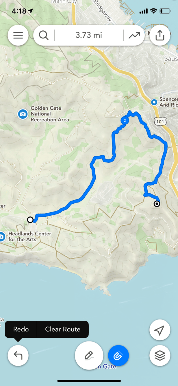
Drawing a route
How to draw a route in Footpath Route PlannerDrawing a route
There are two main ways to draw routes in Footpath:
- Using the “draw” button to trace a route on the map.
- Long-pressing the map to create a route between points.
Choose your activity
You can change your activity in the menu below the search bar. In addition to road and trail related activities, Footpath supports route creation for water sports, snow sports, driving, and much more.
Tracing the map
Tracing the map on an iPhone or iPad will let you choose the exact roads and trails you want for your route. To trace a map:
- Tap the pencil button to enter “draw” mode.
- Trace a path along the map with your finger.
- Footpath will automatically snap your route snap to the closest available paths.
Pro-tip: Footpath will snap more accurately to your chosen route if you zoom in closely. You can also edit your traced path if Footpath snapped to an undesired road or path.
Calculate a route between points
You can also build routes by having Footpath calculate a route between two points. This is a good tool if you’re unfamiliar with an area and want to find the best route between two points of interest.
To calculate a route between your location and a point of interest:
- Long-press the map and select your activity mode.
- Footpath will generate a route to that point.
- Repeat as needed to add more segments or complete the route.
To calculate a route between two points away from your current location:
- Locate your starting point on the map by searching or moving the map.
- Long-press the map and select “Set as Start.”
- Long-press a second point on the map, and Footpath will generate a route between the two points.
- Repeat as needed to add more segments or complete the route.
Pro-tip: Cycling routes in particular will tend to use a route that avoids steep hills and prefers dedicated bike paths.
Disabling “Snap to Map”
By default, Footpath will snap your traces to roads and trails on the map. This makes it quick to create custom routes.
If Footpath is unable a desired route, you can tap the “magnet” button to temporarily disable Snap to Map and manually trace the map.
This is particularly useful if you are planning a route outside established paths and trails, such as along snow, sand, or water.
Once you’re satisfied with your off-road segment, you can re-enable snap to roads and continue mapping your route along known roads and trails.
Tip: While Snap to Map is turned off, switch your map to Satellite and zoom in for the best results while manually tracing the map.
Editing a segment
You can quickly edit your route by tracing over an undesired segment with your finger.
Read more about all of the editing tools here.
Undo a segment
Tap the button in the lower left to undo your last segment.
Pro-tip: You can long press on the undo button for a menu to redo the last segment, or clear the map altogether.
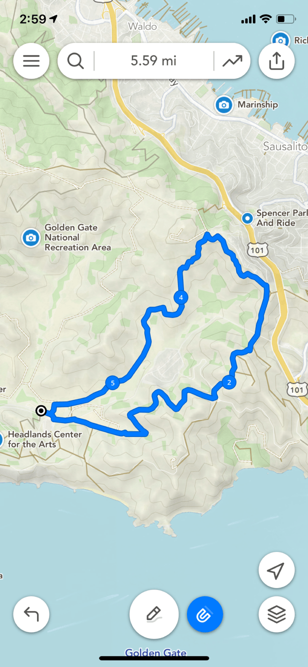
Finishing a route
Tap on the start or end point of the route for a menu of options that will let you “finish” your route:
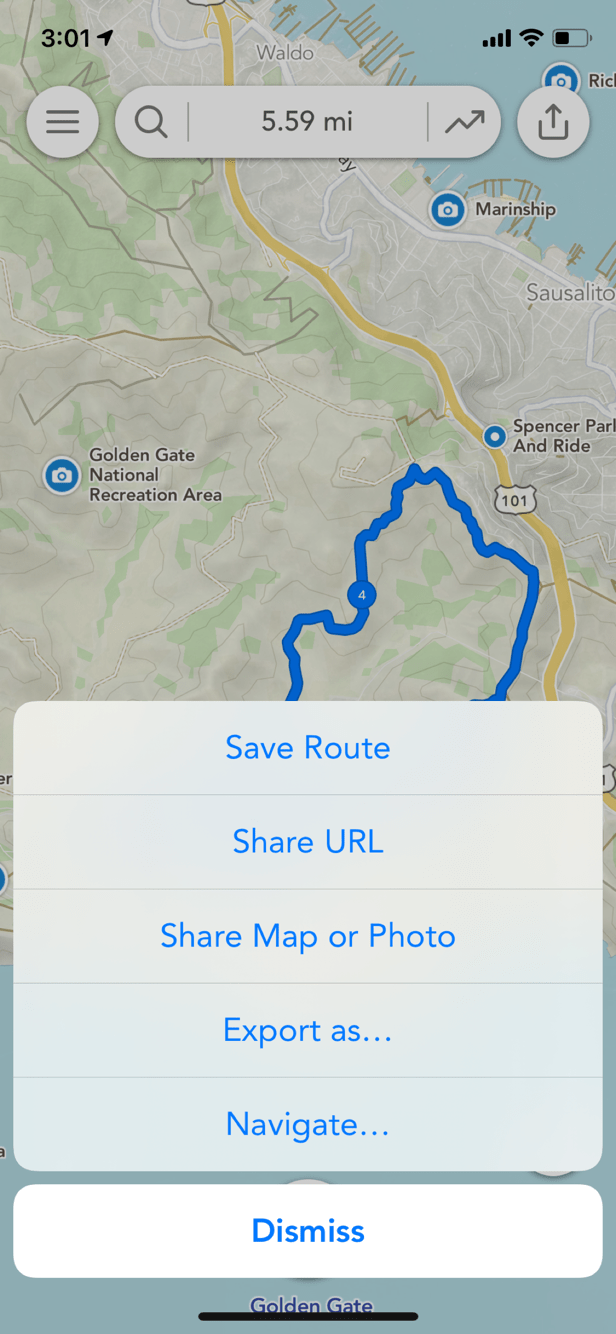
Saving your route
Tap the button in the upper right to save or share your route.
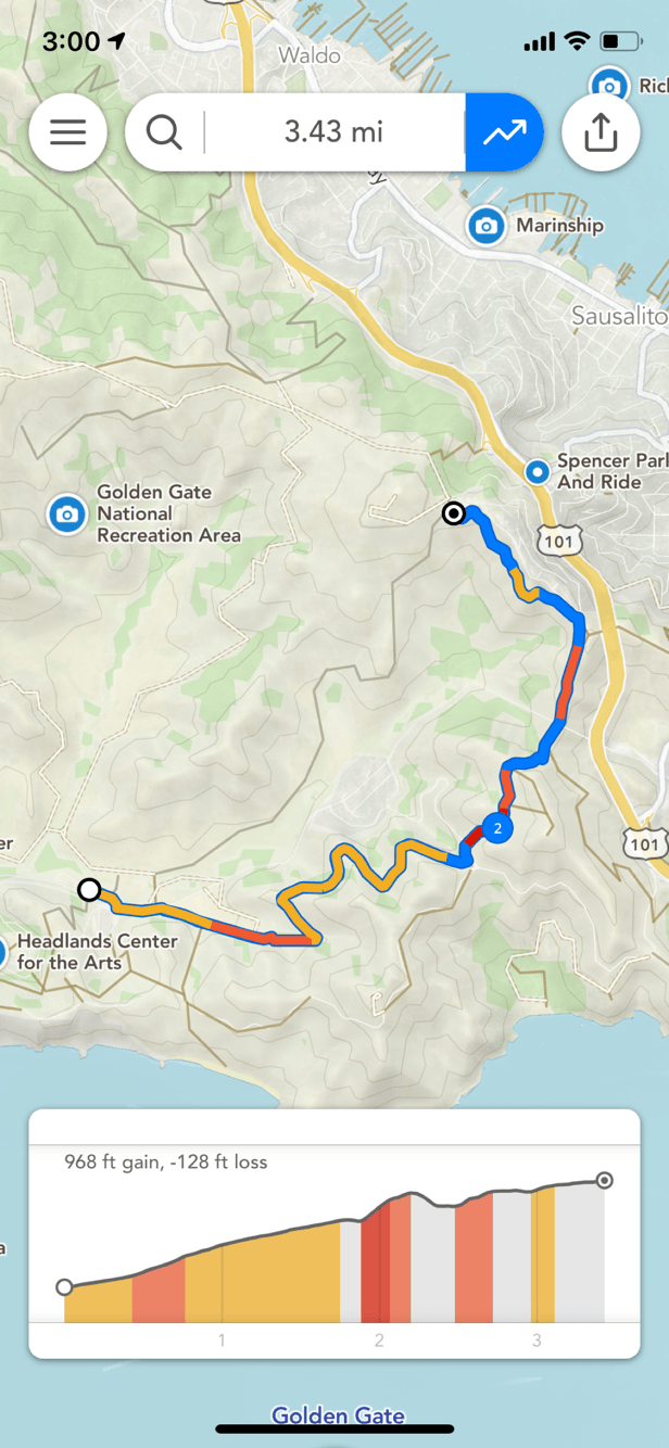
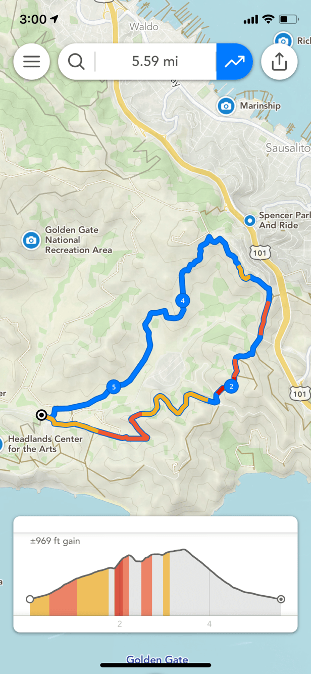
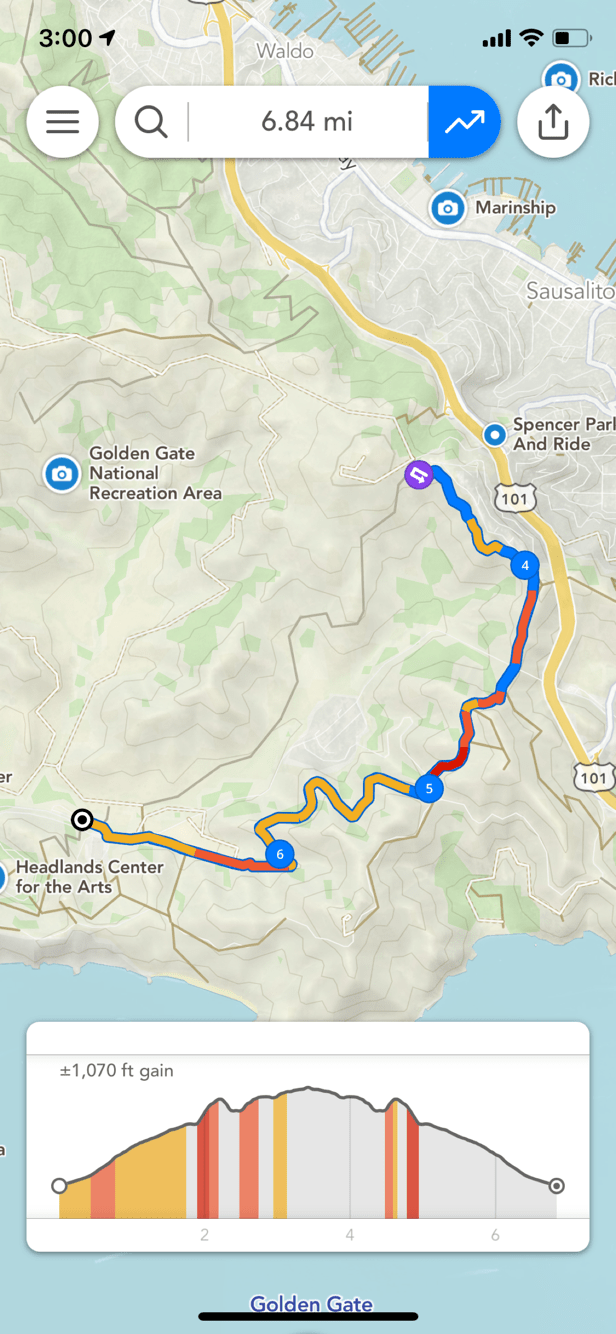
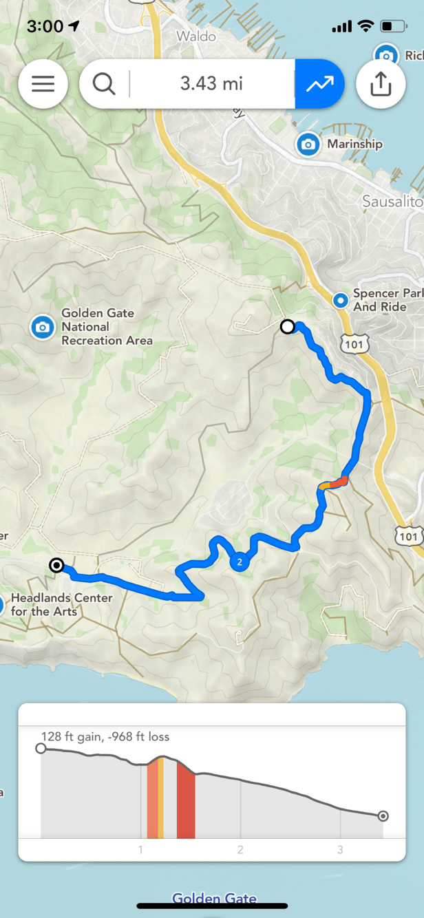
Colors and markers along the route
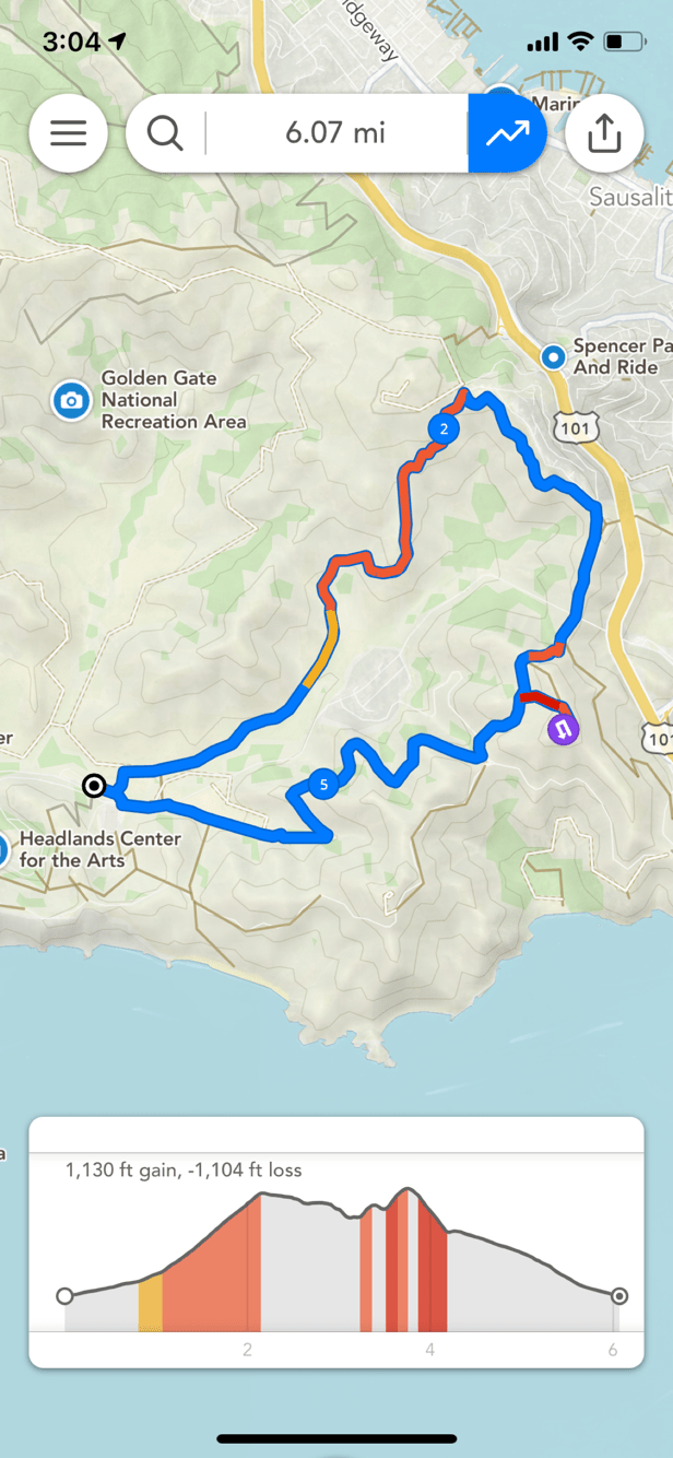
- Blue dots: Mile or kilometer markers.
- Purple dots: Turnaround points indicating you need to make a u-turn at this point. If there are purple turnaround markers that you don’t expect along the route, use the eraser tool over the section to clean up any duplicate segments or unexpected turns.
- Elite Yellow/orange/red segments along the route: These colors indicate steep slopes along the route when you have the elevation profile visible.
Troubleshooting common issues
- Footpath is snapping to roads rather than paths.
- Try zooming in and using your finger to trace your intended path. Footpath’s snapping becomes more accurate as you zoom in.
- My route seems longer than I was expecting.
- Double check that there aren’t any unexpected purple turnaround markers that might indicate an overlapping segment. You can clean these up with the eraser tool.
- Footpath isn’t able to snap to a road or path I see on the map.
- The road may not allow your chosen activity (e.g. many highways will not allow pedestrians). Try temporarily switching activities using the settings button in the lower right.