Contents
- Footpath Basics
- Route Planning
- Organization
- Saving routes
- Creating custom lists
- Editing saved routes
- Merging, duplicating, and splitting saved routes
- Maps
- Navigation
- GPS workouts & trips
- Recording a GPS track
- Logging a workout manually
- Apple Health
- Understanding GPS accuracy
- Syncing workouts with other services
- Import & Export
- Sharing
- Account Management
Elevation profiles
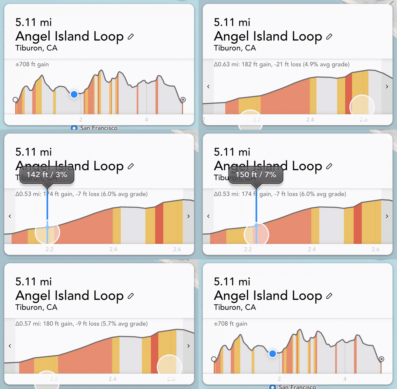
How to use elevation profiles to plan routes over hilly terrainTap the “elevation” button at the top of the route editor to display the elevation profile for a route. This will let you visualize any hills or climbs along a route.
You can slide your finger along the graph to analyze the distance and elevation of any point along the route.
You can also pinch to zoom in on the elevation graph, in case you need to view a particular climb in more detail.

Slope analysis Elite
Footpath Elite unlocks color coded slope or gradient analysis. Footpath will color-code steep sections along the route map that line up with the elevation graph.
You can also view detailed slope/grade values when scrubbing the graph with your finger.
The slope or gradient is measured as a percent grade (ascent divided by distance). For example, a 16 percent grade means that the elevation increases 16 feet in height over 100 feet of distance.
| Color | Gradient | Difficulty |
|---|---|---|
| Yellow | 3-7% | Moderate incline. You may feel this while biking or running. Highways are typically mandated to be 6% or less. 8.3% is the maximum suggested gradient for wheelchairs. |
| Orange | 7-16% | Steep incline. You might need to stand on a bike. This gradient will be typical on a moderately strenuous hike. Trail builders will usually try to keep trails at 10% or less to prevent erosion. Most roads are also designed to be 10% or less to be accessible by fire trucks. |
| Red | 16-25% | Very steep. Biking will become extremely difficult. Usually involves steep switchbacks when hiking. |
| Maroon | >25% (>14°) | Extremely steep. Hikes may involve scrambling past this point. Too steep to climb on a bicycle. |
Footpath will show all ascents steeper than 3% grade on the map when the elevation profile is open. Footpath will also show any decents that are steeper than 16% as a reminder to use caution when descending.
Getting elevations at specific points
After you’ve saved a route, you can tap on any point along the route (or tap and hold anywhere off the route) to calculate the exact elevation at that point.