New maps and interactive POIs

We’ve released a new update to Footpath focused on redesigned maps and interactive points of interest.
Interactive points of interest
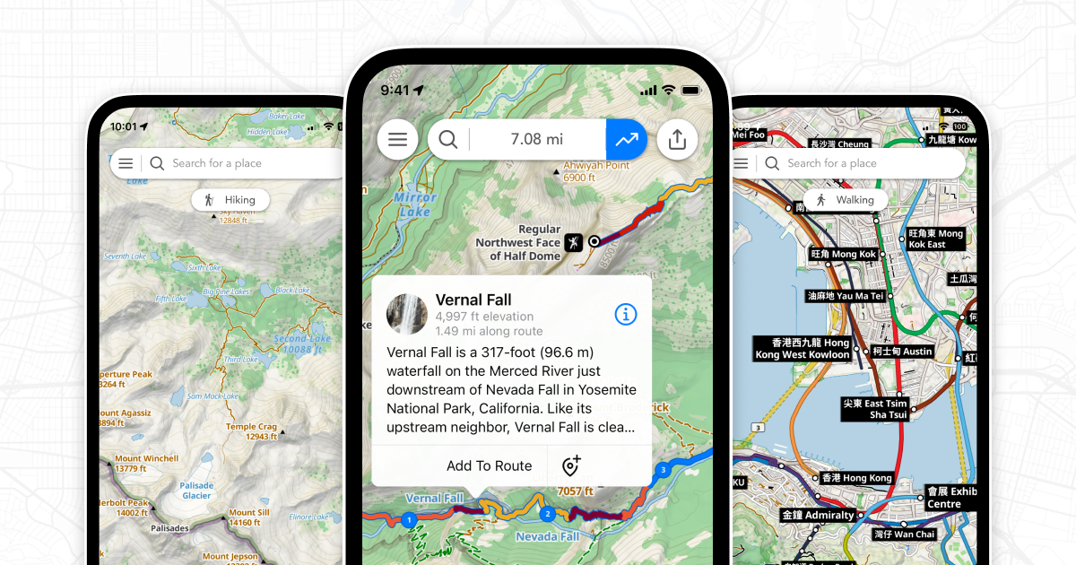
Elite subscribers can now tap on the map to learn more about notable places.
When using the Footpath Topo or Satellite Topo maps, just tap on a POI and you’ll see information about that place from Wikipedia. You can tap the callout to read the full Wikipedia article right from the app, then add it as a waypoint to your route.
New map styles and layers
There’s a new Footpath Topo map style for Elite users designed specifically for pedestrians and cyclists.
We’ve made trails and unpaved roads more visible, highlighted quiet streets and de-emphasized busy roads and highways. We’ve also made national parks, wilderness areas, and national hiking trails easier to find when you’re zoomed out.
These same changes are visible on the Satellite Topo and Satellite Live maps, so you can easily orient yourself with up-to-date imagery, even if there’s snow on the ground.
We’ve also added a new public transit overlay in the map settings that will show subways, light rail, and commuter train lines and stations right on the map. Hop on a train and explore a new part of town!
Send multiple routes to Apple Watch

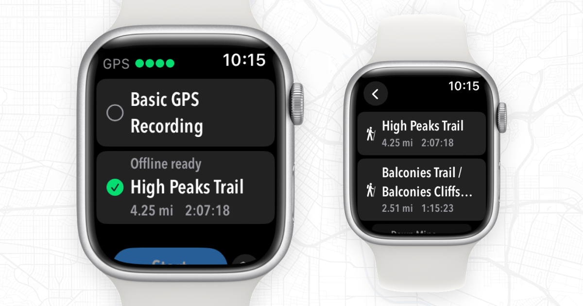
You can now send more than one route to your Apple Watch. Once you’ve sent your routes to your watch, select whatever route you want to use right from the Apple Watch app.
This is perfect for people heading out on multi-day backpacking trips. You can send each day’s itinerary to your Apple Watch and have all of the maps downloaded and ready to use offline.
We’ve also fixed an issue where long, complex routes could fail to transfer to the Apple Watch app. Now you can send routes of any length to the Apple Watch—perfect for all you long-distance cyclists and ultrarunners out there.
Elevation profiles during navigation
![]()
Last year we introduced elevation profiles to the Apple Watch app. Now you can also access these same elevation profiles the navigator on iOS.
Just load up a route into the GPS tracker for turn-by-turn navigation, and you can track your progress on an elevation profile. The graph will automatically zoom in as you approach climbs, so you’ll know exactly how far it is until the top.
Customizable metrics screens
Just like on Apple Watch, you can now long press on a metric in the iOS Tracker, and you’ll be able to customize the metric displayed.
Download the newest 4.10 version of Footpath from the App Store today.