
Footpath for Professionals
Empower your audience with world-class navigation
Share detailed route maps with premium Footpath Elite features automatically unlocked for every recipient: no payments required.
How it works
With an active Footpath for Professionals account, all you have to do is share a route. Recipients instantly gain access to all premium features for that route.
Plan your route
Create detailed routes with waypoints, cue sheets, and elevation profiles using Footpath's planning tools.
Share a link
Send your route to anyone via link, embed it on your website, or share it with your entire group.
Elite features unlocked
Recipients automatically get full Footpath Elite access for that route—no payment, upgrade, or subscription needed.
Premium features for every recipient
When you share a route, Footpath Elite features are instantly unlocked for that route on your recipients' devices.
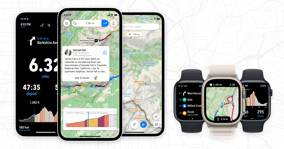
Turn-by-turn audio navigation
Audio-guided directions so recipients can follow any route hands-free.
Premium topographic maps
Footpath Topo, USGS, Ordnance Survey, IGN, and more.
Color-coded elevation profiles
Detailed elevation charts with slope analysis and climb breakdowns.
Offline map downloads
Download maps for saved routes — routes work without cell service.
GPS device exports
Export to Apple Watch, Garmin, Wahoo, COROS, and Suunto.
Premium map overlays
Rights of way, bike paths, and trail network overlays.
Built for professionals
Additional tools designed for guides, race directors, and outdoor organizations.
Embeddable maps
Embed interactive route maps on your website with Footpath's premium topographic maps and elevation profiles.
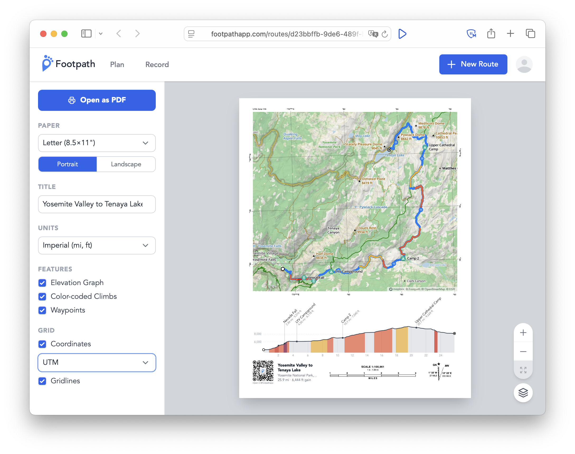
Print maps
Export printed maps for use in race packets, itineraries, guidebooks, and marketing materials. Users can scan a QR code for quick access on their devices.
Live tracking
Track an individual in real-time powered by Garmin InReach. Let your crew and followers follow along on expeditions and FKT attempts.
Who is this for?
Run clubs & coaches
Share weekly routes with your group. Every member gets turn-by-turn audio navigation and premium maps automatically.
Race directors & events
Publish course maps with detailed aid station waypoints, elevation profiles, and device exports.
Guides & tour operators
Give clients professional route maps with offline support, topo maps, and navigation — no setup on their end.
Also used by outdoor shops, content creators, hotels & Airbnbs, visitor centers, and public works teams.
Ready to get started?
Contact us for access to start sharing premium route experiences with your audience.