Footpath
User Guide Pricing
New Route
Login

web

Release Notes

Footpath 3D terrain maps and more

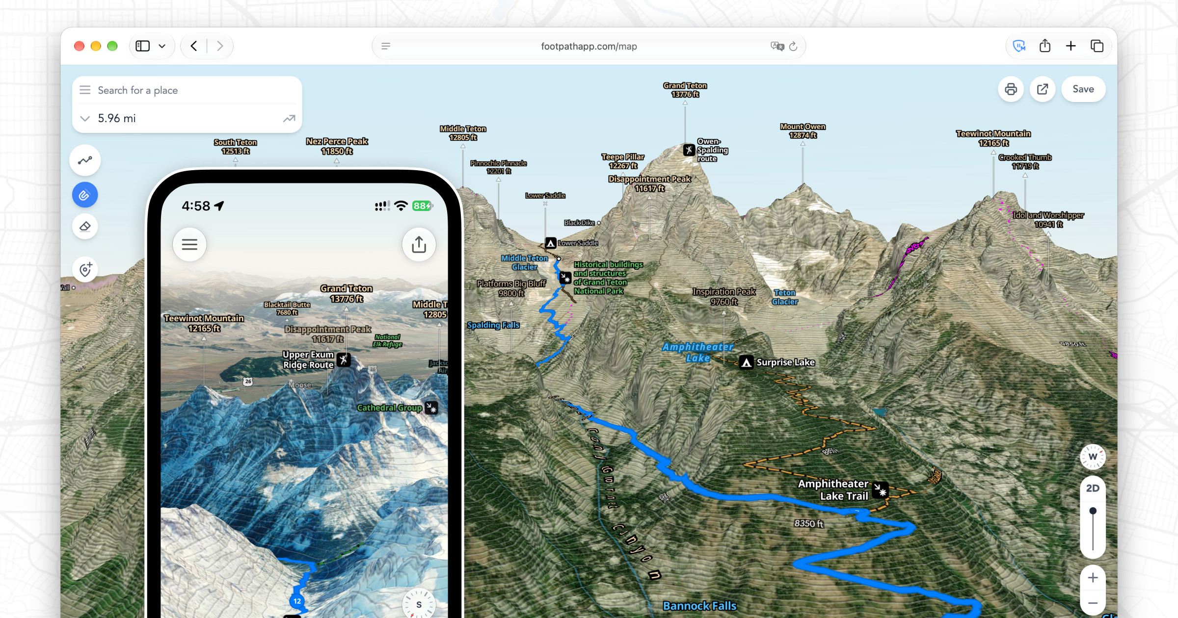
We’ve just launched major new updates for iOS, Android, and Web that add high resolution 3D terrain mapping across the globe, for any of our map styles. As a Footpath Elite subscriber, you can tilt, rotate, and zoom your maps to scope out mountains and canyons from every angle to prepare for your next adventure. Combine this with our Satellite Live maps or Slope Angle shading for clearer understandings of potential winter avalanche conditions.
Release Notes

Introducing Print Maps

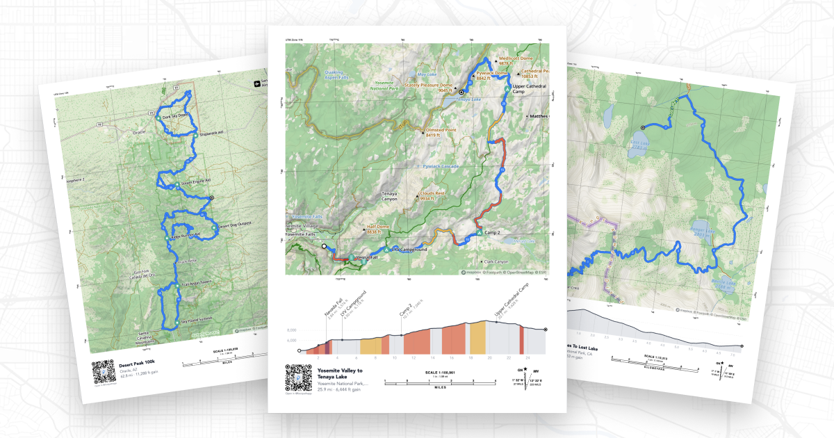
For serious adventurers, a good paper map is still an essential piece of kit, and if you’re a race director, trip leader, or community organizer, having a shareable visual helps others understand the course at a glance. Today, we’re making it easier than ever to create printed maps of your routes. Introducing Print Maps, a new feature for Footpath Elite subscribers that lets you generate high-quality, print-ready PDF maps of any route in your library.

App
  • Pricing
  • Blog
  • User Guide
  • FAQ
  • For Professionals
  • Email Support
Follow
  • Twitter
  • Instagram
  • Facebook
  • Press Kit
Download
  • Download on the App Store
  • Get it on Google Play
  • © 2025 Half Mile Labs LLC
  • Terms of Service
  • Privacy Policy
  • [email protected]