Stay up to date with Footpath's latest releases, tips and tricks, and more.
Inspiration
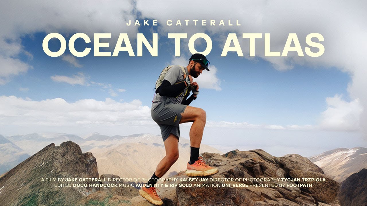
Now streaming on YouTube: Ocean to Atlas
We teamed up with Jake Catterall to capture his recent quest to travel from the Atlantic coast of Morocco to the High Atlas Mountains, finishing at the summit of Mount Toubkal, the highest peak in North Africa at 4,167 meters. The 348 km route, which Jake built entirely in Footpath, climbs 13,652 meters and weaves together rugged trail and long stretches of road through a formidable landscape. Along the way, he battled extreme heat, high elevation, tricky crew vehicle logistics, and the constant need to manage water and salt intake.
Tips
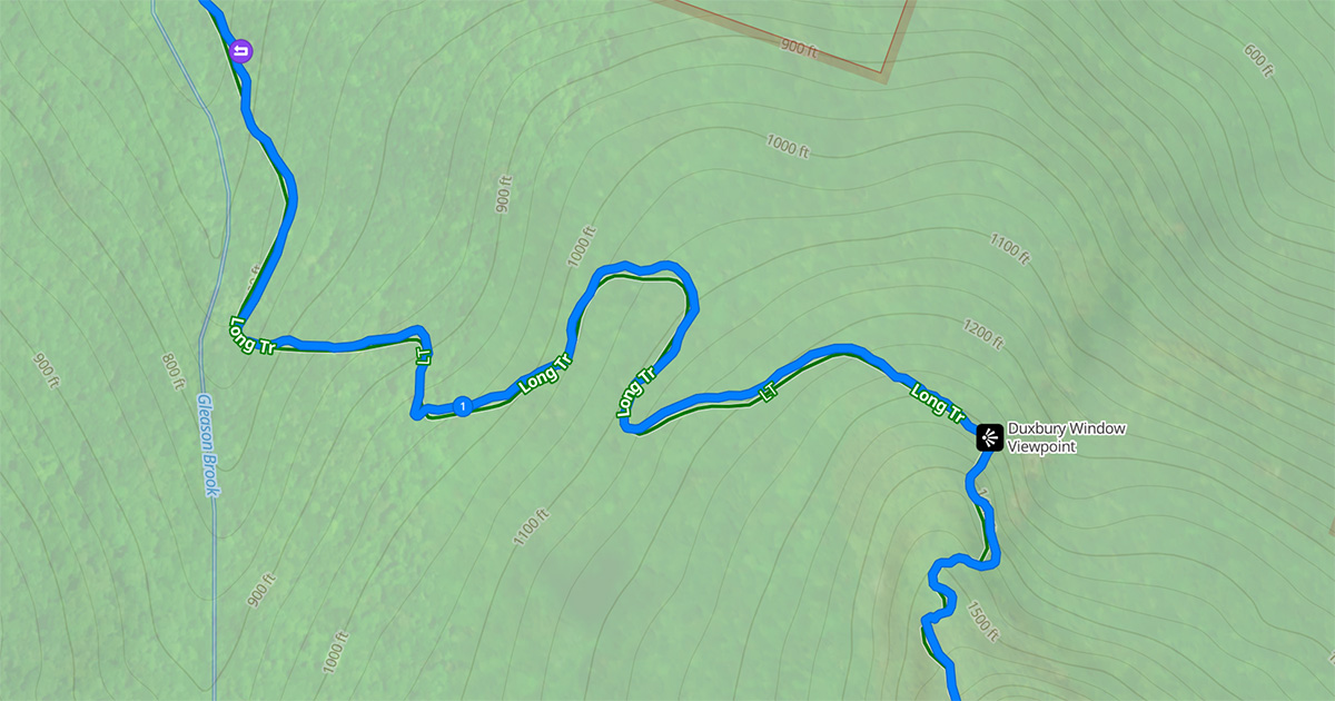
How to clean up GPX files in Footpath
If you have ever uploaded or imported a GPX file only to find the line zig-zagging off the trail, floating through the woods, or cutting corners, you know how messy map lines can be. At first glance, the route might look fine, but when you zoom in, you may see it drifting off the actual road or trail and wandering through places you never intended to travel. These small inaccuracies can be confusing while navigating and will throw off your distance and elevation stats.
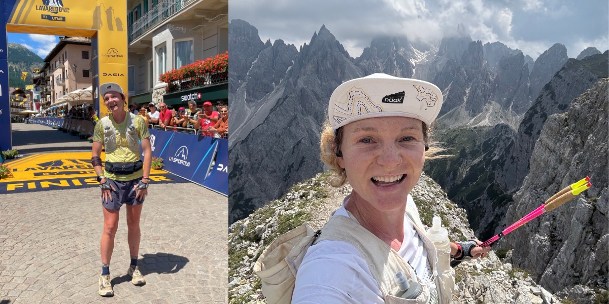
Alyssa Clark on the Artistry of Mapping
Meet Alyssa Clark. Professional runner for On, coach, cat mom, and all-around stellar human, Alyssa just claimed 2nd place at the Lavaredo 120K, finishing only 29 minutes and 11 seconds behind the legendary Courtney Dauwalter. We sat down with Alyssa to uncover how route planning factored into her race strategy. From course recon runs in the Dolomites to precision shakeout routes mapped in Footpath, every line she plotted boosted her confidence and left her fully prepared for race day.
Overtraining in running and how to train smarter
Most runners have brushed up against it, some of us have barreled straight through it. Overtraining. It’s that sneaky state where too much running, not enough recovery, and a lack of planning collide into a perfect storm of fatigue, plateaued performance, and sometimes even injury. It’s easy to fall into this trap, especially as a newer runner when every group run feels like an exciting new adventure. You show up, run faster than usual because it’s fun pushing the pace with friends, and before you know it, your performance is not where you want it despite all the miles.
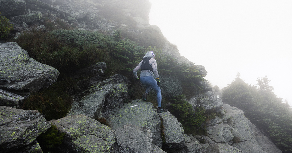
Route planning for multi-day adventures
Planning a multi-day backpacking, running, bike touring, or ski mountaineering trip can feel overwhelming, but it doesn’t have to. With Footpath, you can easily map, organize, and adjust your entire adventure from the palm of your hand (or your laptop), using powerful tools built specifically for outdoor explorers. We’re excited to have partnered with Amsterdam-based ultrarunner Jake Catterall to help share his incredible journey: a 350-kilometer supported run from the coast of Morocco all the way to the 4,167m (13,671 ft) summit of Mt.
How Olympic distance runner Graham Blanks maps victory
For professional distance runner Graham Blanks, training isn’t just about putting in the miles, it’s about making every run intentional. A standout at Harvard University and sponsored by New Balance, Blanks is a two-time NCAA Champion who won back-to-back NCAA Division I Cross Country titles, only the 4th athlete in NCAA history to do so, and the youngest since Steve Prefontaine. He took that success to the world stage, competing in the men’s 5000m at the 2024 Olympics, where he placed 9th in the final with a time of 13:18.
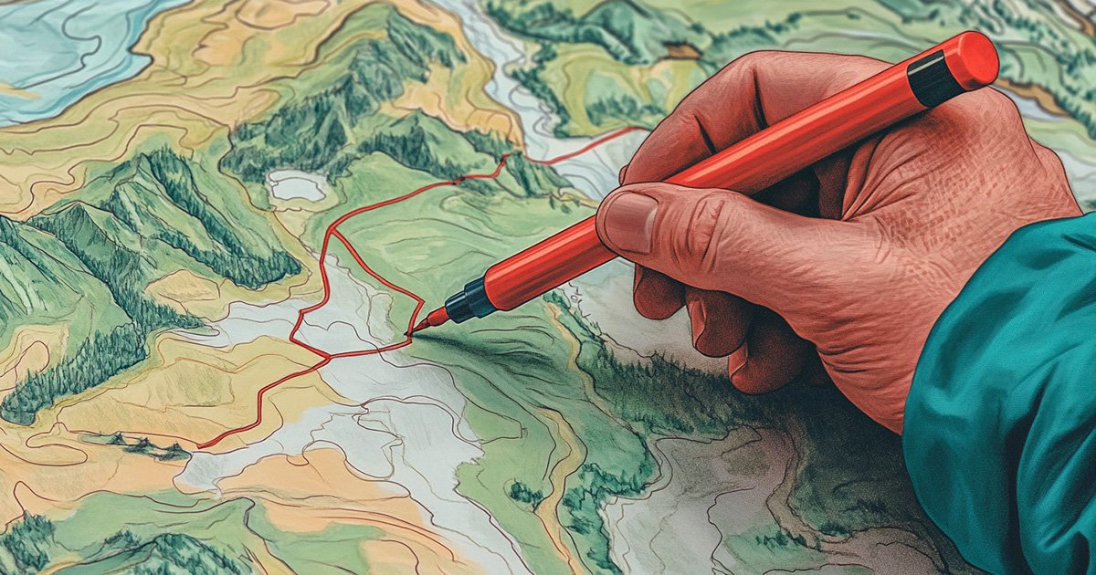
The Art of Mapping
At Footpath we believe that mapping is not just a means to an end but an art form, a way to engage deeply with the environment before ever setting foot on the trail.
Release Notes
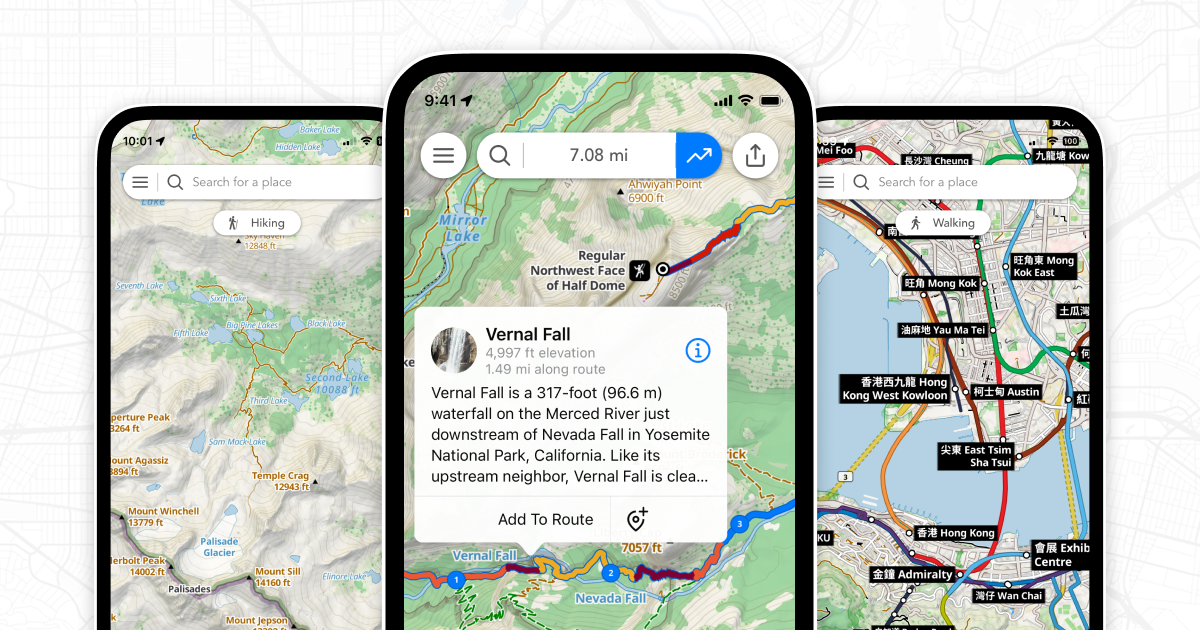
New maps and interactive POIs
We’ve released a new update to Footpath focused on redesigned maps and interactive points of interest. Interactive points of interest Elite subscribers can now tap on the map to learn more about notable places. When using the Footpath Topo or Satellite Topo maps, just tap on a POI and you’ll see information about that place from Wikipedia. You can tap the callout to read the full Wikipedia article right from the app, then add it as a waypoint to your route.
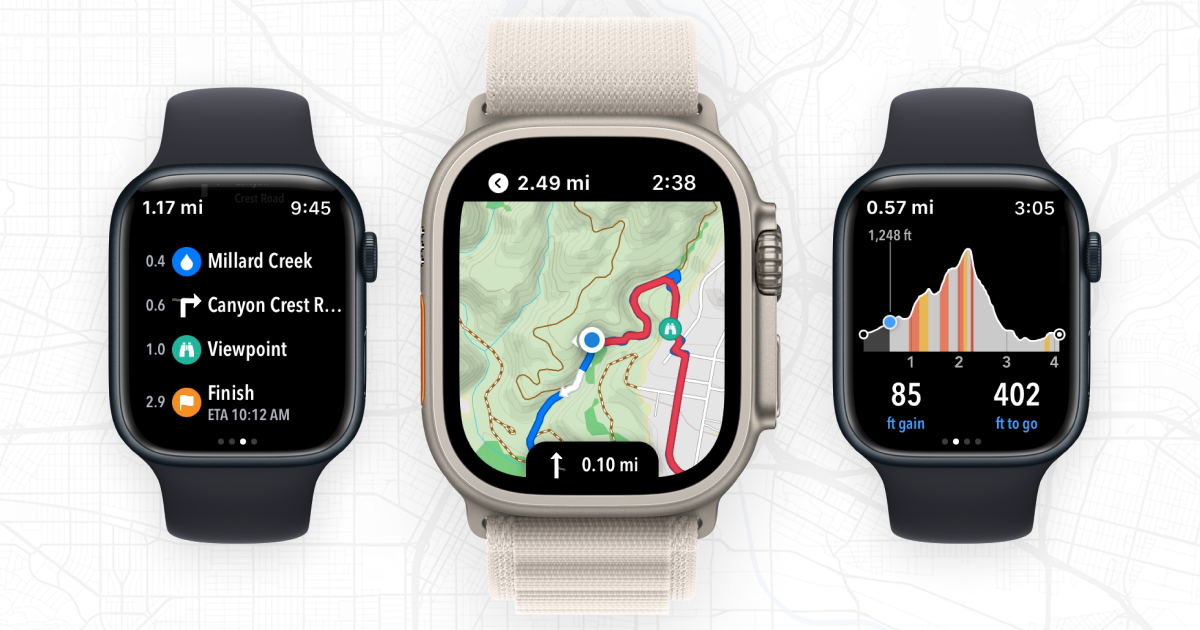
Topo maps for Apple Watch
We’re excited to announce a major update to Footpath that brings exciting new navigation features to the Apple Watch. Footpath is already the best app for turn-by-turn audio navigation on the Apple Watch, and today we’re making your watch even more powerful with offline topographic maps, elevation profiles, and upcoming waypoints. Navigate entirely offline, even without your phone. Footpath transforms the Apple Watch into a world-class outdoor navigation device. And, with the extra battery life of the Apple Watch Ultra, you’ll be able to tackle any race or adventure you can dream of.