Contents
- Footpath Basics
- Route Planning
- Organization
- Saving routes
- Creating custom lists
- Editing saved routes
- Merging, duplicating, and splitting saved routes
- Maps
- Navigation
- GPS workouts & trips
- Recording a GPS track
- Logging a workout manually
- Apple Health
- Understanding GPS accuracy
- Syncing workouts with other services
- Import & Export
- Sharing
- Account Management
USGS Topo Elite
View the legend for the USGS Topo map style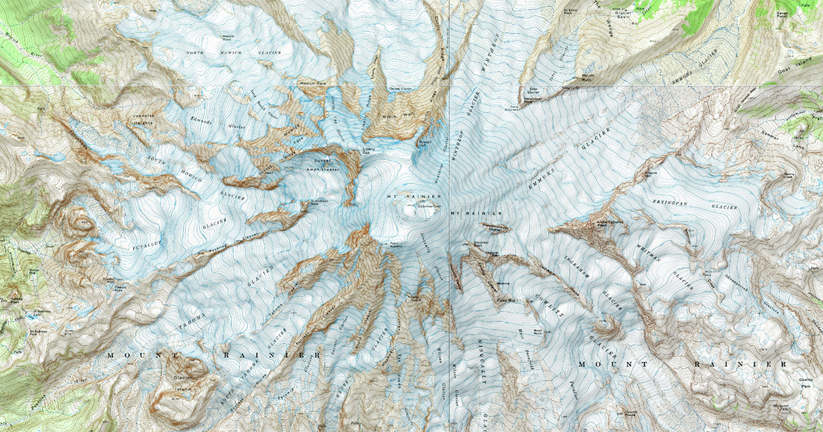
The USGS Topo map style is available to Footpath Elite users, and has coverage for the continental United States, Hawaii, and Alaska.
This map style uses scans of the 1:24,000 (7.5’) USGS quadrangles. The majority of these maps were last updated in the 1990s.
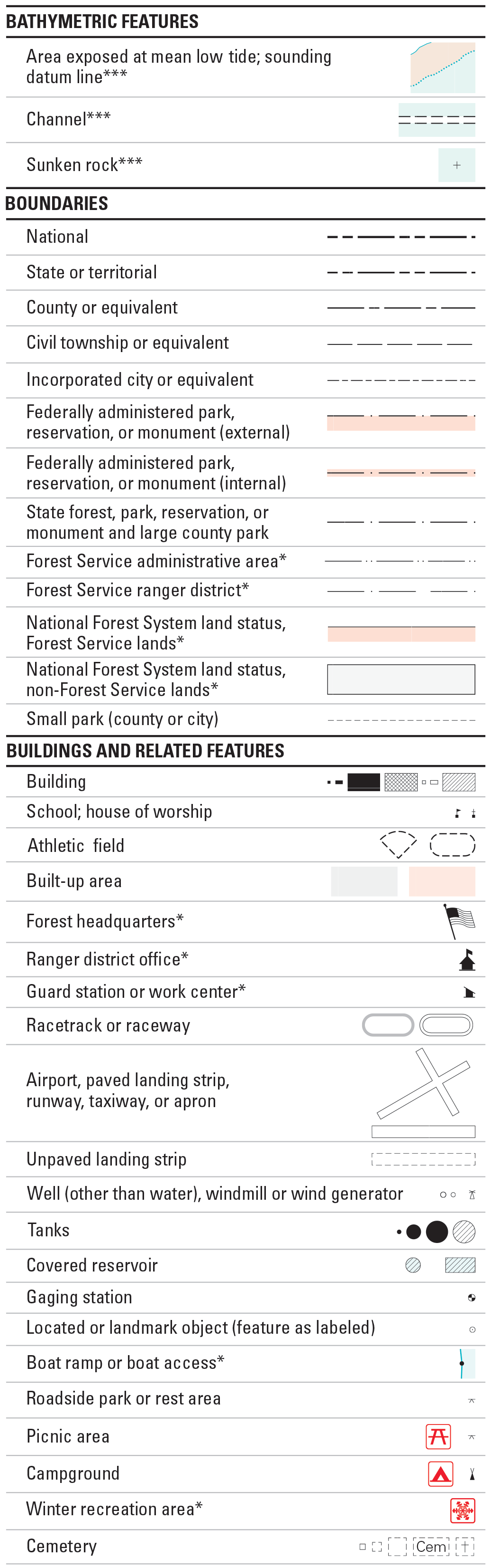
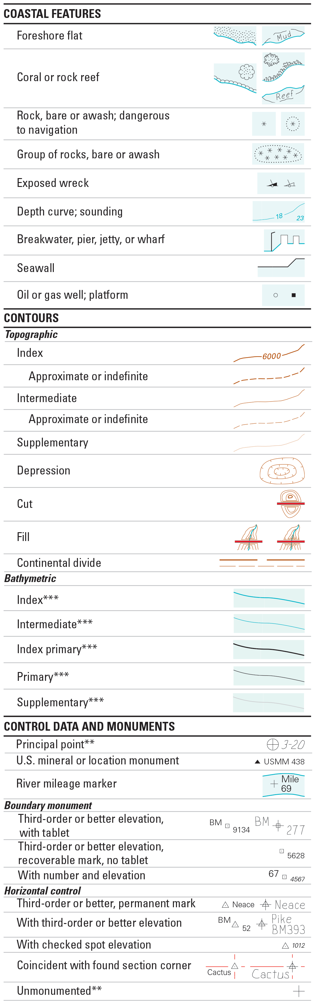
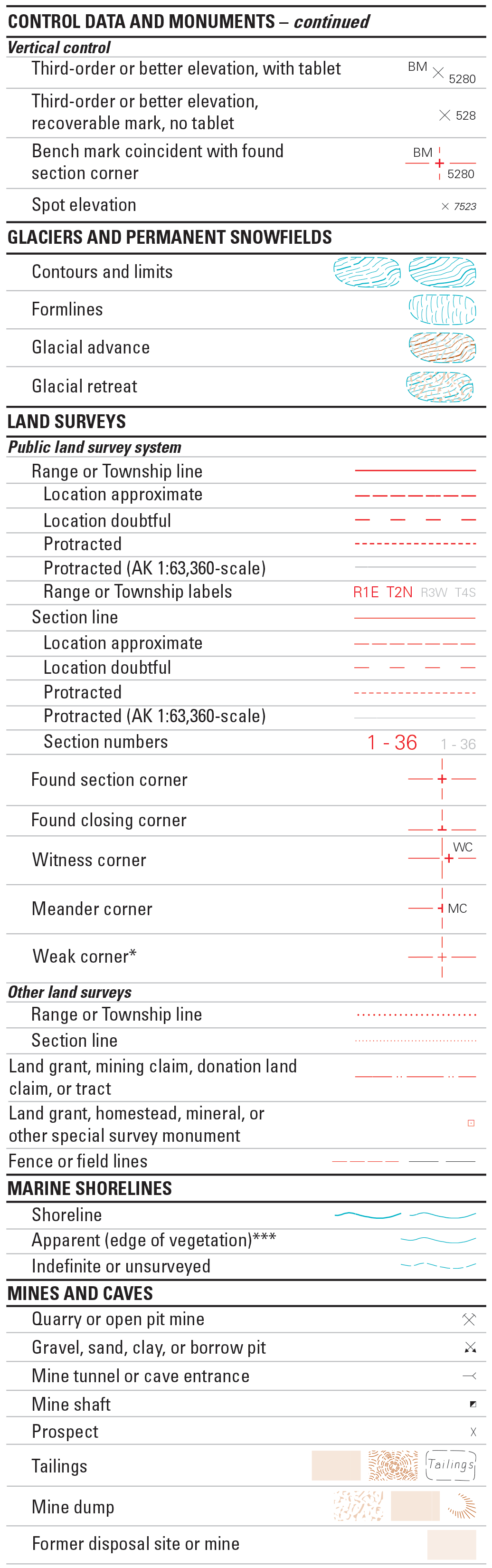
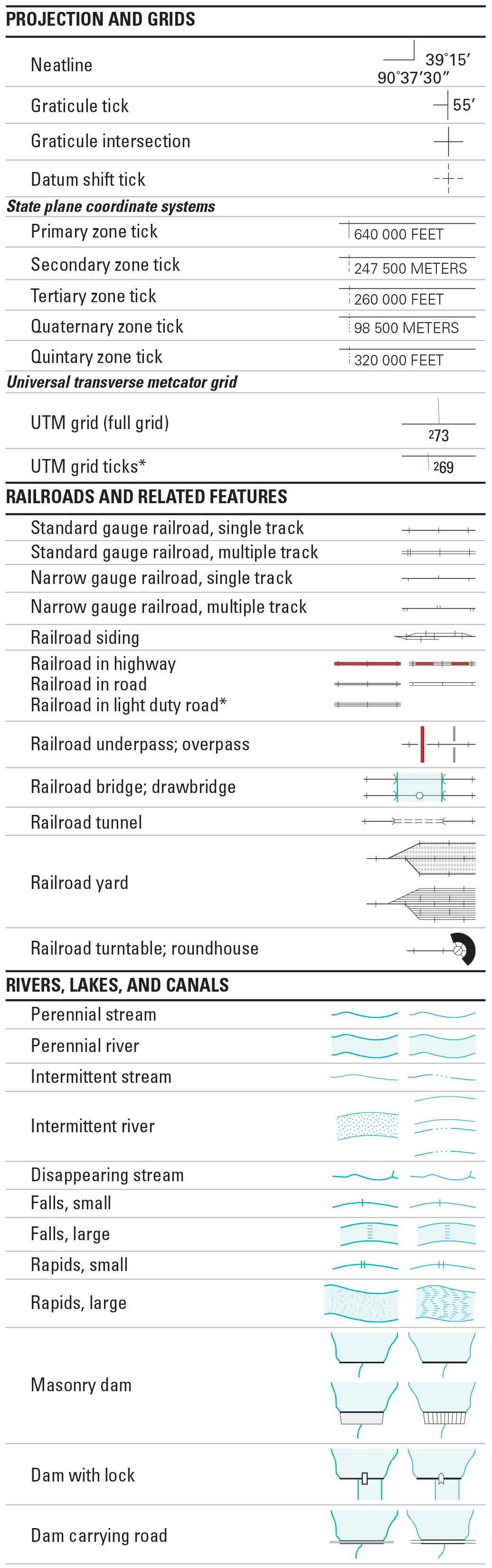
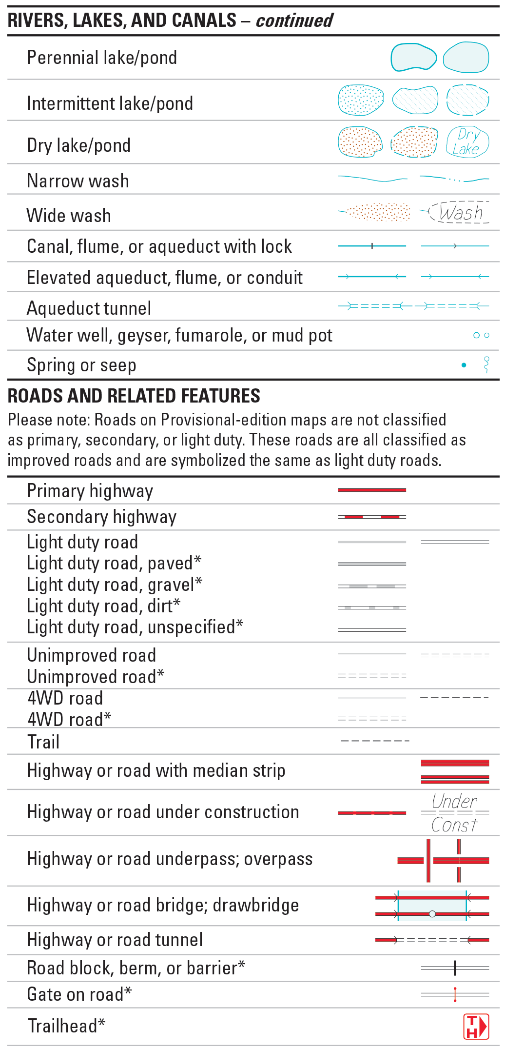
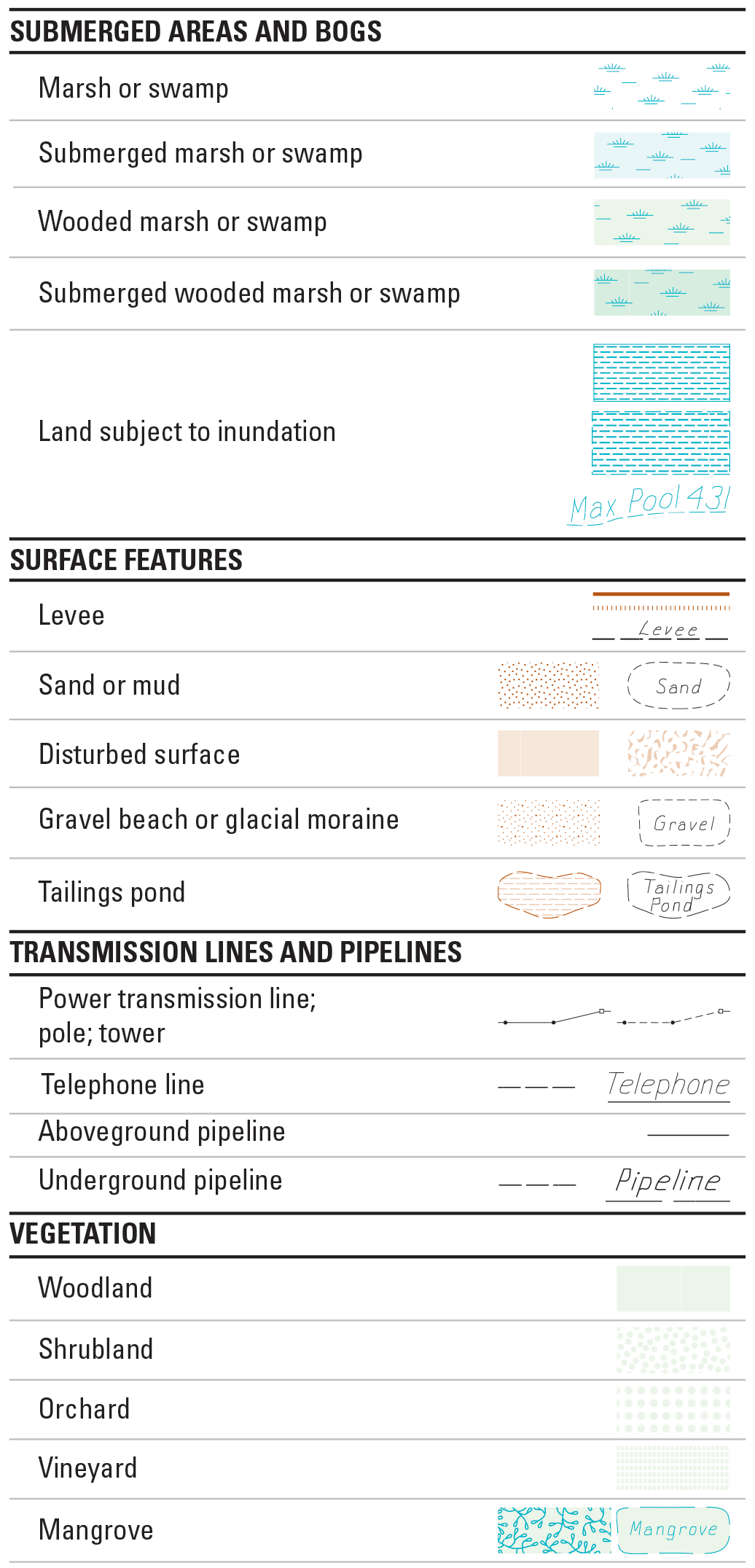
You can find the offical map legend here.