Contents
- Footpath Basics
- Route Planning
- Organization
- Saving routes
- Creating custom lists
- Editing saved routes
- Merging, duplicating, and splitting saved routes
- Maps
- Navigation
- GPS workouts & trips
- Recording a GPS track
- Logging a workout manually
- Apple Health
- Understanding GPS accuracy
- Syncing workouts with other services
- Import & Export
- Sharing
- Account Management
Contour lines Elite
View the legend for the Contour Lines map overlay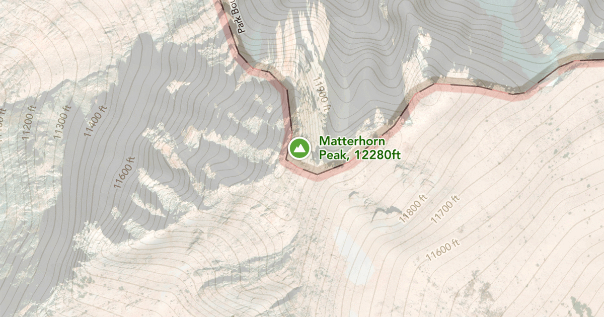
The contour lines overlay is available to Footpath Elite users using the Footpath Topo map style. Free users can see basic contour lines, but the labels indicating the contour elevations are not displayed.
You can use this overlay to adjust the contour elevation labels for display in meters or feet.
Contour lines indicate the overall topography of the terrain. When the lines are spaced closer together, it indicates steeper terrain. In particularly rugged areas, you might be interested in the slope angle overlay.
You can find a detailed guide on how to read contour lines here.